Transportation Planning
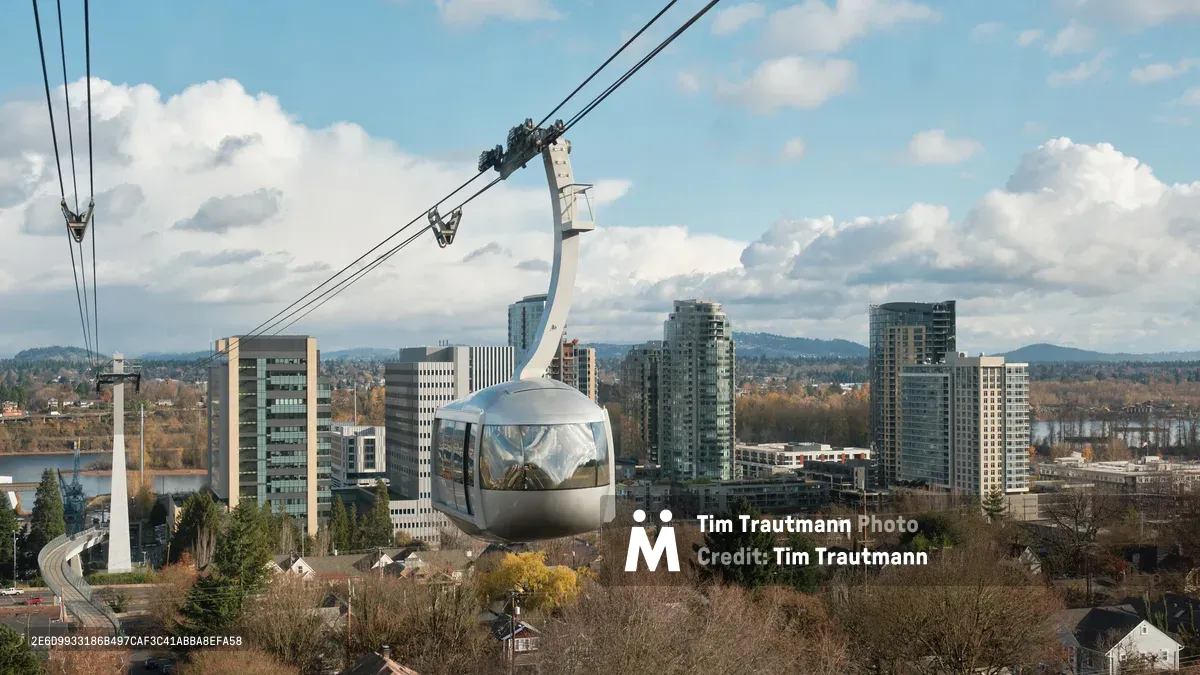
Portland Aerial Tram Glides Over South Waterfront
The Portland Aerial Tram approaches its upper terminal at Oregon Health & Science University, offering passengers sweeping views of the city's South Waterfront district and the Willamette River beyond.
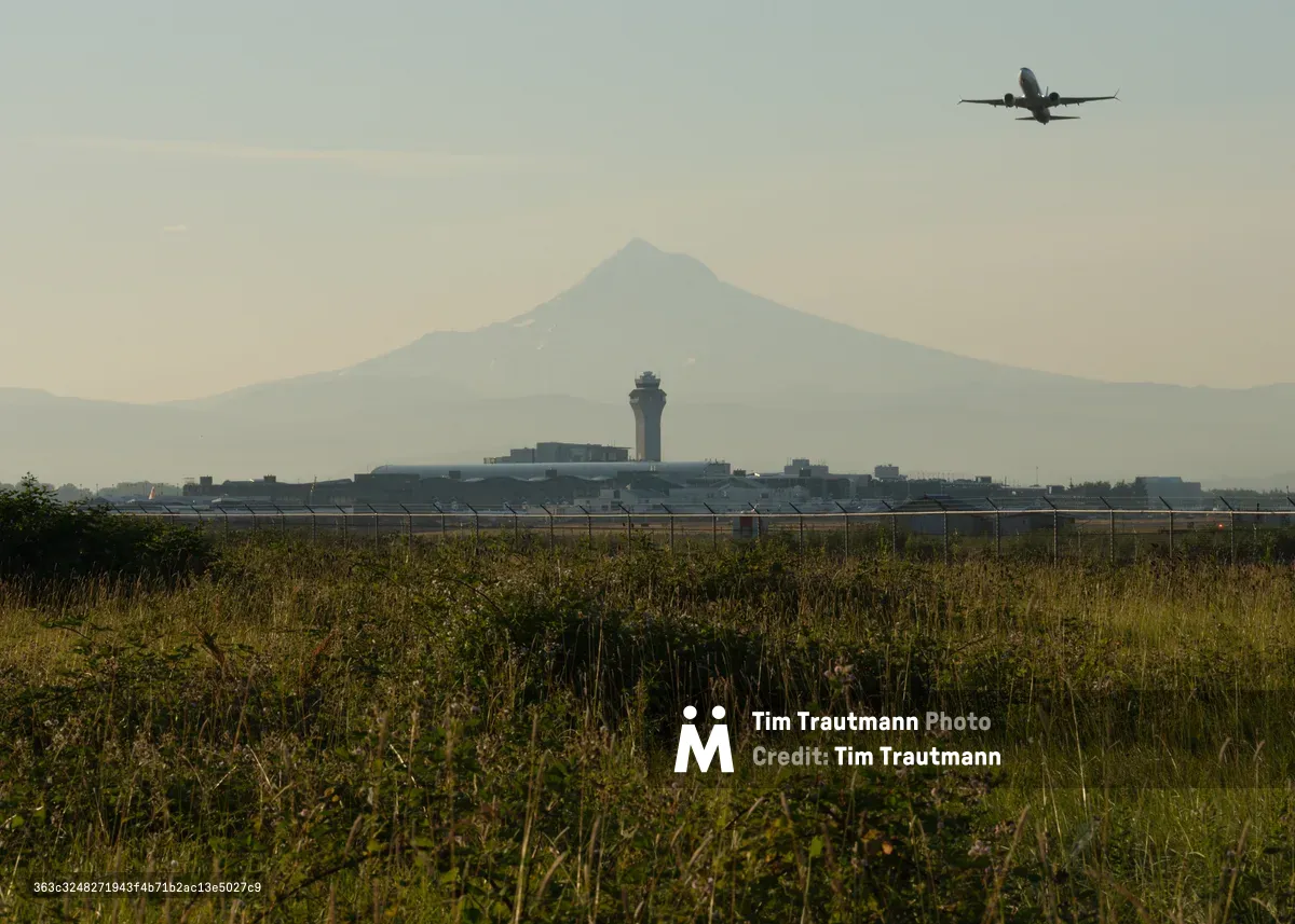
Departure Over Mount Hood's Shadow
A passenger jet departs Portland International Airport with the volcanic cone of Mount Hood providing a dramatic backdrop in Oregon's Columbia River Gorge region.
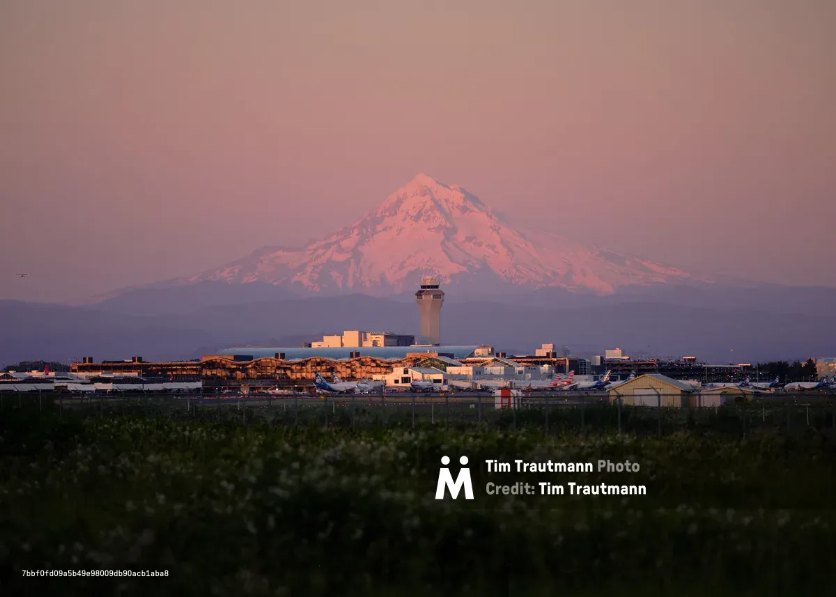
Alpenglow Illuminates Mount Hood Above Portland Airport
Mount Hood's snow-covered peak catches alpenglow behind Portland International Airport's terminal and control tower during the golden hour.
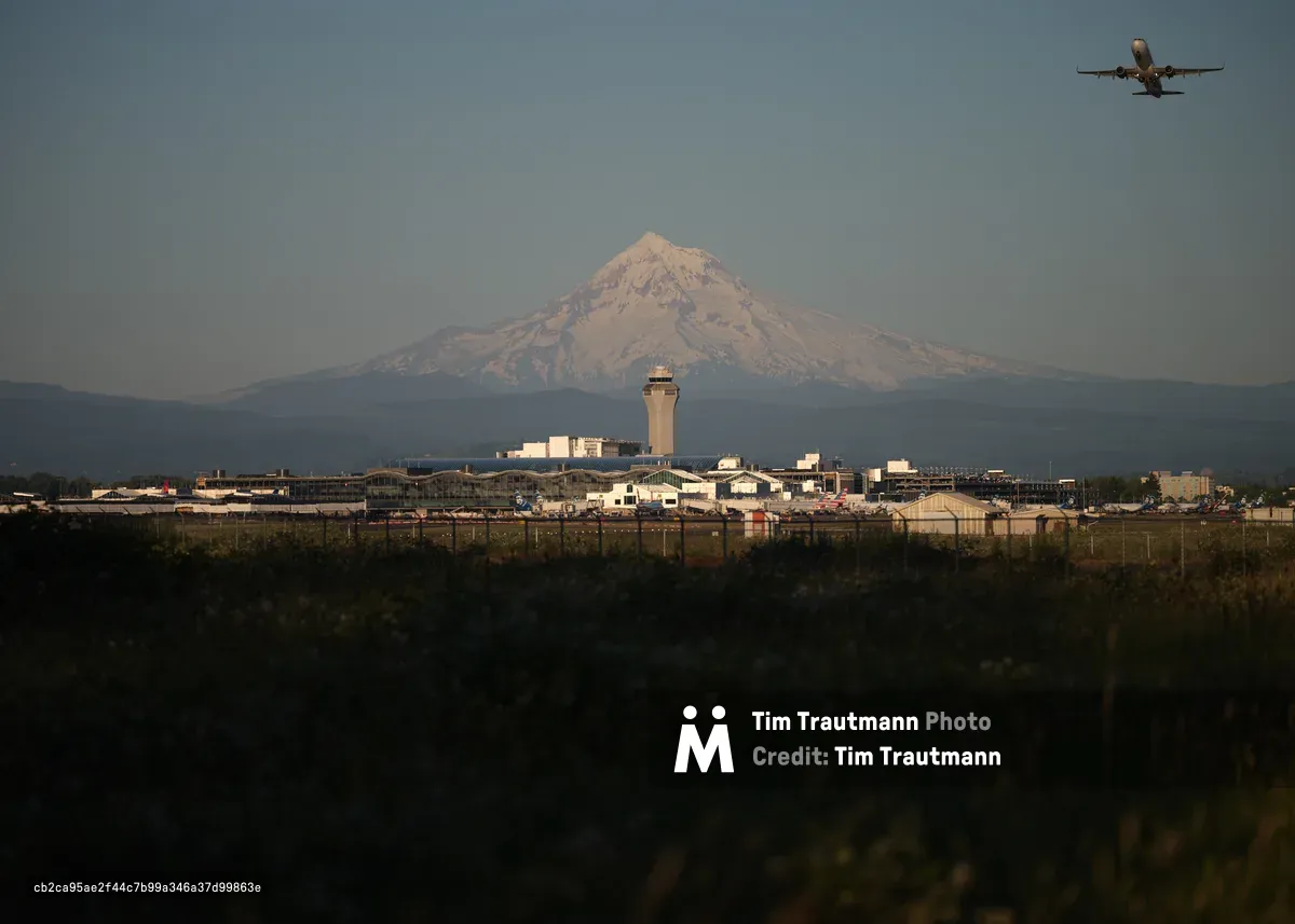
Mount Hood Sentinel Over Portland International
A departing aircraft soars above Portland International Airport with the glaciated slopes of Mount Hood commanding the horizon in Oregon's Cascade Range.
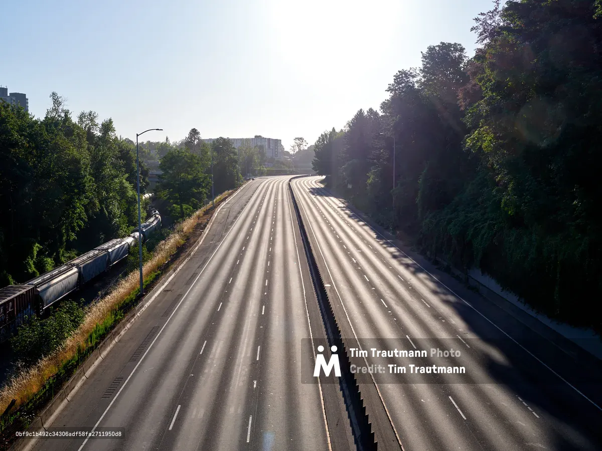
Empty Banfield Freeway in Portland Oregon
The Banfield Freeway sits empty in Portland's Lloyd District, surrounded by dense urban forest and bathed in morning sunlight.

Oregon Highway with Deer Crossing Sign at Sunset
The Lower Columbia River Highway in Svensen, Oregon features wildlife crossing signs to alert drivers of deer in this heavily forested region of Clatsop County.
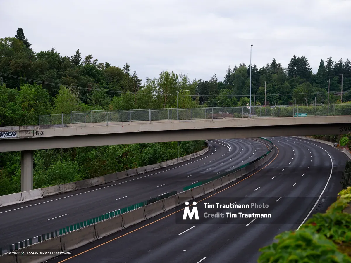
Empty Highway Curve with Overpass in Portland Oregon
The famous Terwilliger Curves section of highway winds through Portland's Hillsdale neighborhood, showcasing the city's integration of transportation infrastructure with its abundant natural landscape.
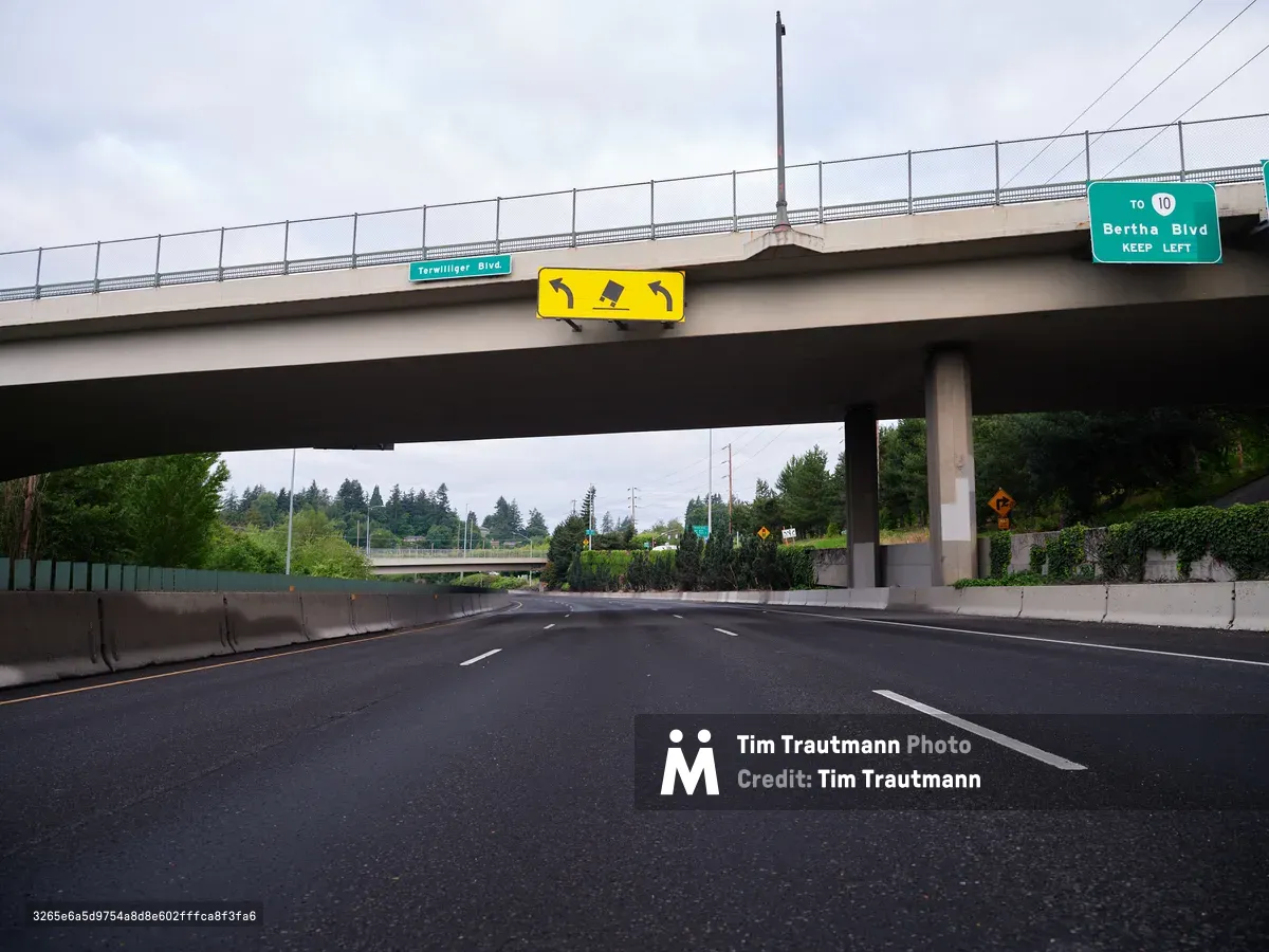
Highway Overpass at Terwilliger Curves Portland Oregon
Traffic flows beneath the Terwilliger Curves overpass in Portland's Hillsdale neighborhood, where Highway 10 crosses this scenic roadway known for its winding path through forested terrain.

Jersey Corridor
A conductor leans against the glass of a passing NJ Transit train near the Interstate 95 viaduct in Kearny, New Jersey.
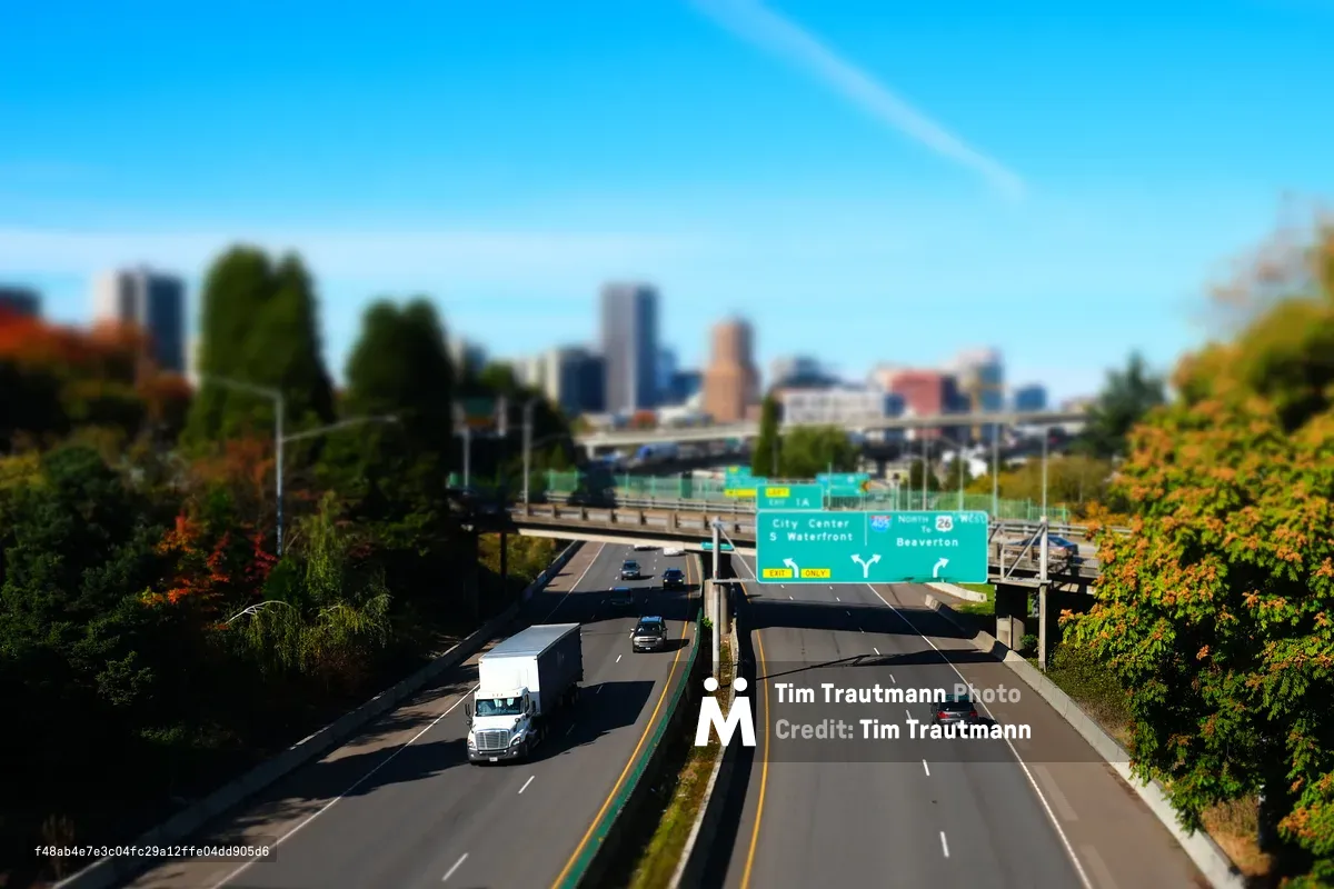
Toy Town Freeway
A tilt-shift view of Interstate 5 northbound through South Portland, with the downtown skyline in the distance.